Hiking in Nature
Routes between forests and mountains
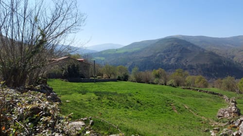
Routes for all levels
Discover routes adapted to all levels, from quiet walks to more demanding routes, always surrounded by nature and unique landscapes
Route 1
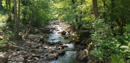
The itinerary begins in Barcena Mayor, the only town included in the Saja Besaya Natural Park, declared a Historic-Artistic Site in 1919. The route allows you to travel the entire length of the non-lodar, ascending the entire basin of the Fuentes Ravine to the point where its waters join the Hormigas River, in the area of Pozo de La Arbencia, and then up to the Puertos de Fuentes. The route constitutes a magnificent observatory of the Natural Park, since it brings together most of the ecosystems of this protected space, from the meadows or brarias of the surroundings of the Alto de la Cruz de Fuentes, with the characteristic stands of holly trees, to the leafy forests that appear as we ascend, the oak and chestnut groves of the surroundings of Barcena Mayor, or the riverside environments of the fluvial courses
Route 2
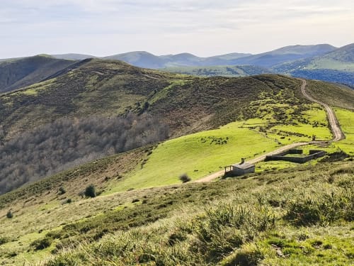
We start from Bárcena Mayor crossing the Galles, a medieval village, declared a Historic-Mystic site in 1979, and after crossing the bridge over the Argoza river we go up, to the left, towards the hermitage of Carmen.
In the first part of the ascent we can observe chestnut trees and centenary oaks. The mixed forest of the environment is a mixture of ash, oak, birch and hazelnut trees. Leaving the hermitage behind, the oaks (Quercus pyrenaica) and some specimens of arbutus seem to draw a Mediterranean landscape that contrasts with the beech forest on the right bank of the river Quenendo.
In the first part of the ascent we can observe chestnut trees and centenary oaks. The mixed forest of the environment is a mixture of ash, oak, birch and hazelnut trees. Leaving the hermitage behind, the oaks (Quercus pyrenaica) and some specimens of arbutus seem to draw a Mediterranean landscape that contrasts with the beech forest on the right bank of the river Quenendo.
Route 3
It runs through the northwest sector of the Natural Park. Part of the recreational area of the Casa del Monte, to the east, partially crossing the park known as Casa del Tio Mero.
It can be done in either direction, so we suggest ascending the old road from Ucieda to Geza, leaving the track on the left that will take us back to this point. The first section of the Camino saves the widest drop 1ante; the daros in front of the path offer a good opportunity to observe the development of gorse and heathland formation.
Livestock uses and recent management formulas give the forest a humanized and somewhat denatured appearance. In fact, it soon becomes clear that the density of livestock use is important and this means that the regeneration of the forest is stagnant; there are fewer young specimens and the beech and oak seedlings are one of the foods selected by the cows, which also cut the holly trees, pulling out the tender shoots and limiting their development.
Route 4
It starts next to the old sawmill of the Casa del Monte, following to the south the track that goes to the Braña del Moral. After passing the Casa Andinoso we enter the forest, to the left of the track, on a short wooden walkway with steps. From here the trail does not leave except to approach the Jou de la Colla braña and the uninhabited village of Rozas. The braña, elliptical in shape, is covered in spring by chamois, which were once harvested as food for pigs, and appears dominated, on a short hill, by a curious shepherds' hut. In Rozas we will see the ruins of a village that was abandoned during the seventeenth century when the way of life settled in the population centers at the bottom of the valley. We will also deviate a few meters from the road to visit the lying oak, a magnificent and spectacular specimen included in the Open Inventory of Singular Trees of Cantabria
Route 5
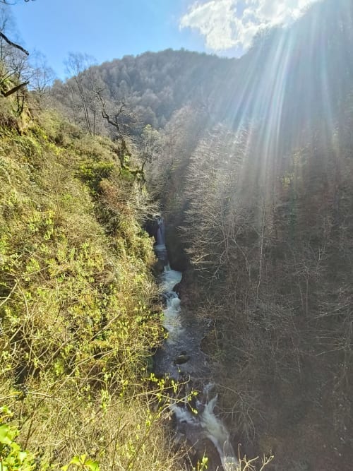
It runs entirely on land of the Mancomunidad Campo Cabuemiga. The route begins at kilometer 25 of the CA-280 road, Cabezón de la Sal- Renosa, in an environment known as Jaya Cruza". The first part of the route is an approach to the confluence area of the rivers Bijoz and Cureñas, which receives the allusive toponym of Tramburrios. Following the often plentiful flow of the latter, along its right bank, the visitor's attention will be attracted by a relevant patch of sessile oak (Queras petrea), which is not very common in the forests of Cantabria. On the opposite slope, the non-uniform red sandstone reliefs of the Molinuscos del Diablo, at the foot of Cueto La Concilla, are one of the geological attributes of the route. At the upper limit of the beech forest, a stunted pole birch is faithful evidence of the adaptability of this species in the roof of the Cantabrian forest. The access to the Puertos de Sejos through the Sel del abedul allows a wide panoramic view of the northern slope of the Sierra del Cordel